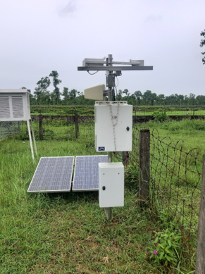
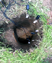
Ocean Condition Monitoring Systems
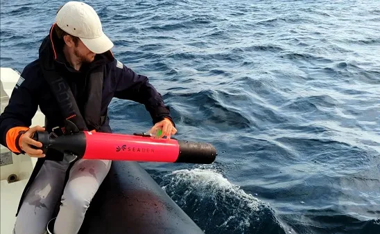
- Acoustic Doppler Current Profiler (ADCP)
ADCP is a hydroacoustic current meter that uses the Doppler effect to measure water current velocities over a depth range. ADCPs are used in a wide variety of applications, including oceanography, coastal engineering, river engineering, environmental monitoring, and marine biology.
ADCPs work by emitting a pulse of sound waves into the water. The sound waves travel through the water and interact with particles in the water column. The particles scatter the sound waves back to the ADCP. The ADCP measures the frequency of the scattered sound waves. The Doppler effect causes the frequency of the scattered sound waves to be higher when the particles are moving towards the ADCP and lower when the particles are moving away from the ADCP. The ADCP uses the change in frequency to calculate the velocity of the particles.
ADCPs are used in a wide variety of applications, including Oceanography, Coastal Engineering, River Engineering, Environmental Monitoring, Marine Biology.
Oceanography
- To measure the speed and direction of ocean currents at different depths. This information can be used to understand how the ocean circulates, which is important for understanding how the ocean affects weather and climate.
- To measure the height and frequency of ocean waves. This information can be used to understand how waves interact with the coast and how they can affect ships and boats.
- To study the effects of ocean currents on marine life. For example, ADCPs can be used to track the movement of fish and to identify areas where fish are likely to be found.
Coastal engineering
- To measure the rate of coastal erosion. This information can be used to design and implement coastal restoration projects, such as seawalls and breakwaters.
- To measure the rate of sediment transport in coastal areas. This information can be used to design and implement river restoration projects, such as dams and levees.
- ADCPs can also be used to study the effects of waves on coastal structures. For example, ADCPs can be used to track the movement of sand and to identify areas where waves are likely to cause erosion.
River engineering
- To measure the speed and direction of river flow. This information can be used to design and implement river restoration projects, such as dams and levees.
- To measure the rate of sediment transport in rivers. This information can be used to design and implement river restoration projects, such as dams and levees.
- To study the effects of waves on river structures. For example, ADCPs can be used to track the movement of sand and to identify areas where waves are likely to cause erosion.
Environmental monitoring
- To track the movement of pollutants in water. This information can be used to identify areas where pollution is a problem and to take steps to reduce or eliminate pollution.
- To assess the impact of climate change on water currents. This information can be used to develop strategies to adapt to climate change and to mitigate its effects.
Marine biology
- To study the movement of fish and other marine life. This information can be used to understand how fish interact with their environment and to identify areas of high fish concentration.
- To study the effects of pollution and climate change on marine life. This information can be used to develop strategies to protect marine life from pollution and climate change.
ADCPs are a valuable tool for scientists and engineers working in a variety of fields. They provide accurate and detailed information about water currents, which can be used to understand and manage the environment.
- Conductivity Temperature & Depth (CTD)
The Conductivity, Temperature, and Depth (CTD) instrument is a versatile tool used to measure the physical properties of seawater. It is an essential piece of equipment for oceanographers and other scientists who study the ocean and other water body. CTDs measure the electrical conductivity, temperature, and pressure of seawater. This information can be used to calculate the salinity of the water, which is a measure of how much salt is dissolved in the water. Salinity is an important factor in many oceanographic processes, such as the formation of currents and the distribution of marine life.
The number of parameters that can be measured with a single CTD depends on the specific CTD and the sensors that are included. However, most CTDs can measure at least the following parameters:
- Electrical conductivity,
- Temperature,
- Pressure,
- Salinity,
- Dissolved oxygen, and
Some CTDs can also measure other parameters, such as:
- Chlorophyll-a (Fluorescence),
- Turbidity,
- Specific conductance,
- Specific gravity,
- Density, and
- Sound speed etc.
This information can be used to study the health of the ocean and the effects of human activities on the ocean environment. The choice of parameters that are measured will depend on the specific needs of the scientists involved. However, all CTDs provide valuable information about the physical properties of seawater, which can be used to understand and protect the ocean environment. In general, the more parameters that are measured, the more comprehensive the dataset will be. However, it is important to note that each additional parameter that is measured will add to the cost of the CTD and the complexity of the data analysis.
Table: Shows the number of parameters that can be measured with some common types of CTDs:
Type of CTD | Number of parameters |
Basic CTD | Up to 10 |
Advanced CTD | Up to 20 |
Research-grade CTD | 20 and more |
The two main types of CTDs, along with some of their specific features and capabilities:
Profiling CTDs
- Mounted on a frame that allows them to be lowered into the water and raised back to the surface.
- Can measure the physical properties of the water at different depths.
- Typically equipped with sensors that measure electrical conductivity, temperature, and pressure.
- Can also be equipped with sensors that measure other water parameters, such as dissolved oxygen, pH, and fluorescence.
- Used for a variety of purposes, including studying the ocean’s circulation, mapping the ocean floor, and studying the distribution of marine life.
Bottom CTDs
- Designed to remain on the ocean floor.
- Used to measure the physical properties of the water at a single depth.
- Typically equipped with sensors that measure electrical conductivity, temperature, and pressure.
- Can also be equipped with sensors that measure other water parameters, such as dissolved oxygen, pH, and fluorescence.
- Used for a variety of purposes, including studying the ocean floor, monitoring the health of the ocean, and studying the effects of human activities on the ocean environment.
In addition to these two main types, there are also a variety of other CTDs available, each with its own specific features and capabilities. For example, some CTDs are designed to be used in harsh environments, such as the Arctic or the deep ocean. Others are equipped with sensors that can measure specific water parameters, such as the concentration of nutrients or pollutants.
The choice of CTD for a particular project will depend on the specific needs of the scientists involved. However, all CTDs provide valuable information about the physical properties of seawater, which can be used to understand and protect the ocean environment.
Here are some additional examples of Profiling CTDs:
- CTD Rosette
- A CTD rosette is a type of profiling CTD that is equipped with a number of sensors that measure different water parameters. This allows scientists to collect a more comprehensive dataset of water properties.
- The sensors are mounted on a frame that is lowered into the water. As the frame is lowered, the sensors measure the water properties at different depths. This allows scientists to create a profile of the water properties throughout the water column.
- Niskin bottles are sealed bottles that are attached to the CTD rosette. As the rosette is lowered into the water, the bottles are opened at specific depths. This allows scientists to collect water samples from different depths in the water column.
- Niskin bottles are a valuable tool for studying the distribution of chemicals and nutrients in the ocean. They are also used to collect samples of marine life for further analysis.
- Fluorescence CTD
- A fluorescence CTD is a type of profiling CTD that is equipped with a sensor that measures the fluorescence of the water. This can be used to study the distribution of phytoplankton in the ocean.
- Phytoplankton are microscopic plants that live in the ocean. They are important for the ocean ecosystem because they produce oxygen and absorb carbon dioxide. The fluorescence of phytoplankton is a measure of their concentration in the water.
- Fluorescence CTDs are used to study the distribution of phytoplankton in the ocean. This information can be used to understand the role of phytoplankton in the ocean ecosystem and the effects of human activities on phytoplankton populations.
- Microprofiler
- A microprofiler is a type of profiling CTD that is designed to measure the physical properties of the water at very small depths. This can be used to study the structure of the water column and the distribution of small organisms in the ocean.
- The sensors on a microprofiler are typically mounted on a very thin wire. This allows the microprofiler to be lowered into the water very slowly. This ensures that the sensors measure the water properties at very small depths.
- Microprofilers are used to study a variety of processes in the ocean, including:
- The mixing of the water column
- The distribution of small organisms
- The transport of nutrients
- The formation of fronts
- Microprofilers are a valuable tool for studying the small-scale processes that are important for the ocean ecosystem.
These are just a few examples of the many different types of CTDs that are available. The choice of CTD for a particular project will depend on the specific needs of the scientists involved. However, all CTDs provide valuable information about the physical properties of seawater, which can be used to understand and protect the ocean environment.
- Autonomous Underwater Vehicle (AUVs)
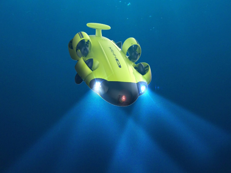
AUVs are robots that travel underwater without requiring continuous input from an operator. AUVs constitute part of a larger group of undersea systems known as unmanned underwater vehicles, a classification that includes non-autonomous Remotely Operated Underwater Vehicles (ROVs) – controlled and powered from the surface by an operator/pilot via an umbilical or using remote control. In military applications an AUV is more often referred to as an Unmanned Undersea Vehicle (UUV). Underwater gliders are a subclass of AUVs.
There are many reasons why AUVs are important for scientists. Here are some of the most important reasons:
- AUVs can access areas that are dangerous or inaccessible for humans. This includes deep ocean trenches, underwater volcanoes, and shipwrecks.
- AUVs can operate for long periods of time without human intervention. This allows scientists to collect data over extended periods of time, which can be used to study long-term changes in the ocean environment.
- AUVs are relatively inexpensive to operate. This makes them a cost-effective way to collect data from the ocean.
- AUVs are non-intrusive. This means that they do not disturb the ocean environment, which is important for studying sensitive marine ecosystems.
Mapping the seafloor
AUVs can be used to map the seafloor in great detail. This is because they are not limited by the range of a tether, as is the case with remotely operated underwater vehicles (ROVs). AUVs can also travel for longer periods of time than ROVs, which allows them to cover more ground.
The data collected by AUVs can be used to study the geology of the ocean floor, as well as to locate potential resources, such as oil and gas. For example, the U.S. Navy uses AUVs to map the seafloor in search of potential submarine hazards.
Studying marine life
AUVs can be used to study marine life in their natural environment. This is because they are not as disruptive as ROVs, which can scare away marine animals. AUVs can also be equipped with sensors that can detect the presence of marine animals, even if they are not visible.
The data collected by AUVs can be used to understand the behavior of marine animals, as well as to track the effects of pollution and climate change on marine ecosystems. For example, the National Oceanic and Atmospheric Administration (NOAA) uses AUVs to study the migration patterns of whales.
Surveying shipwrecks
AUVs can be used to survey shipwrecks in great detail. This is because they can maneuver in tight spaces and reach depths that would be too dangerous for humans to access. AUVs can also be equipped with sensors that can detect the presence of artifacts, even if they are buried under the sediment.
The data collected by AUVs can be used to study the history of shipwrecks, as well as to locate potential artifacts. For example, the Woods Hole Oceanographic Institution (WHOI) uses AUVs to survey shipwrecks from the Civil War.
Deploying and recovering sensors
AUVs can be used to deploy and recover sensors in the ocean. This information can be used to monitor the environment, such as the temperature and salinity of the water. For example, the Monterey Bay Aquarium Research Institute (MBARI) uses AUVs to deploy sensors that monitor the health of the Monterey Bay ecosystem.
AUVs can be equipped with a variety of sensors to measure a wide range of parameters, including:
Depth: Depth sensors are used to measure the depth of the water. This information is used to navigate the AUV and to avoid obstacles.
Temperature: Temperature sensors are used to measure the temperature of the water. This information can be used to study the ocean’s thermal structure and to track the effects of climate change.
Salinity: Salinity sensors are used to measure the salinity of the water. This information can be used to study the ocean’s salinity distribution and to track the movement of water masses.
Oxygen: Oxygen sensors are used to measure the concentration of oxygen in the water. This information can be used to study the ocean’s oxygen levels and to track the effects of pollution.
Currents: Current sensors are used to measure the speed and direction of currents. This information can be used to navigate the AUV and to study the ocean’s circulation patterns.
Sonar: Sonar sensors are used to create images of the underwater environment. This information can be used to map the seafloor, to study marine life, and to detect shipwrecks.
Magnetometers: Magnetometers are used to measure the Earth’s magnetic field. This information can be used to study the geology of the ocean floor and to track the movement of tectonic plates.
The specific sensors that are used on an AUV will depend on the specific mission that the AUV is being used for. For example, an AUV that is being used to map the seafloor will need to be equipped with a different set of sensors than an AUV that is being used to study marine life. Overall, AUVs are a valuable tool for scientists who are studying the ocean environment. They are capable of collecting data in places that would be difficult or dangerous for humans to access, and they can operate for long periods of time without human intervention. As AUV technology continues to develop, they are likely to become even more important for scientific research.

