GIS and Remote Sensing Solutions
GIS technology
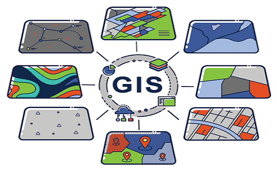
Earlier Geologists, Oceanographers, urban developers, land planners, and foresters used to work hard to gather information for their use. But after GIS mapping has entered the world of technology, these professionals work by using this spatial data as an essential component for planning any project. This database provides sheer information concerned with the topic and even forecasts changes after development. This system provides valuable data for professional help that works best for the projects. Both offline (software based) and online (web-based) GIS are crucial for decision making projects where we are working. It helps through the enlisted points:
- Sharing of data
- Enables analysis
- Spatial data management
- Incurs visualization
- Combines spatial and non-spatial data for analysis
Effective Areas of Operation:
These tools are effective in the following realms of operation:-
- Land management
- Topography and plan of maps
- Gas services and pipeline tracking
- Forest, habitat and species management
- Telecommunication, transport and media services
- Vegetation management
- Marketing and sales to target retail business
- Education and research
- Hydraulic network analysis
- Banking, Insurance and Logistics
- Ground water modeling
- Study of regions for Disaster/Fire/Medical/Emergency service management
- Law enforcement/ Military defense and security measures
This is a breakthrough in the sphere of science and technology. Plus, it even eliminates the use of manual filing systems and map consolidation that in turn increases the velocity of reports for sophisticated infrastructure.
Benefits:
- Minimizes the cost of maintenance of filing and cabinets.
- Data accessible at a single click, user-friendly and totally secure.
- Minimal chances of duplication between departments.
- Provides a consistent and shared pool of information.
- Systematically stored data.
- Flexible options for analysis.
- Provides solutions to sophisticated spatial queries.
The information requires consistent updates based on digitization of realms of infrastructure and maps and this should be of high quality, since these are used for defining future trends.
Digital Mapping:
Digital Mapping is done to show geological features using GIS software. It provides geographical and physical data required for many public and private sector working in the world. We provide geological mapping services with cost effective means. This data is produced to depict the shape, size, structure of the objects shown on geographical maps.
Uses
- Provides enormous knowledge about Earth’s geology and hence provides data for comparison with other planets.
- Geologists identify the areas suitable for urban development and agriculture practices.
- To locate natural resource deposits like coal, petroleum, natural gas etc.
- To locate areas prone to geological hazards like landslide, flood, volcanoes, earthquakes, tsunamis etc.
- To locate mineral deposits and ground water resources.
- Helps building infrastructure like roadways, pipelines, dams, railway track, highways, buildings etc.
- Tracks the hazardous waste disposals for smooth administration.
Remote Sensing technology
Remote Sensing is a branch of science used to take measurements of earth without making actual contact and with the use of sensors placed on satellites. Sensors collect the information in the form of geographical images and enables manipulation, analysis and visualization. These instruments are integrated in GIS software. In this system information is transmitted in the form of electromagnetic radiation (EMR). EMR is a type of energy form that is produced after it strikes a particular matter.
We have a complete knowledge of all necessary elements to conceptualize an ideal GIS and remote sensing system. And we make a thorough use of this knowledge; our GIS application system is integrated with advanced software like geological information database, which helps a lot in tracking down the mishappenings at any corner of the world. We are producing a variety of services by using GIS and remote sensing with comprehensive and limited description according to the requirements.
Land-use-Land-cover:
The Land Use and Land Cover data collection includes global and regional data sets related to the forms of land and the uses of that land, whether natural or influenced by humans. Several of the data sets provide indices of the threat of potential development for setting conservation priorities. Other data sets contain information on the human modification of the land, either by urban expansion or other anthropogenic stressors. Also included are a mangrove land cover data set derived from Landsat imagery and a data set of Central American vegetation, and land cover types based on Advanced Very High Resolution Radiometer (AVHRR) imagery.
Thematic monitoring:
Thematic mapping, generally understood as the extraction of value-added information from raw or pre-processed data, is one of the most common and relevant application fields in remote sensing. It can be divided into sub-categories, such as pattern recognition, feature extraction, and thematic classification. Thematic and land cover maps derived from remotely sensed imagery can support land and environment monitoring, as well as management and planning activities.
Proper response actions to environmental and climate emergencies – floods and landslides, earthquakes and fires, food and water security – are based on updated spatial-temporal thematic knowledge, especially if accessible in a digital cartographic format. This knowledge is useful to the deployment of preliminary actions, the quantification of damage extension and the planning of recovery and prevention measures. The availability of thematic maps is relevant not only in disaster management, but is also a crucial information source for land and environmental management: for example in forestry, mapping is important for both global monitoring of fires and their implications on climate and environment.
Agriculture: Hybrid classification techniques map variety of crops by using NDVI slicing and spectral signatures collected during GPS aided field survey. Crop acreage and product estimates are done to support exporters. So that they can plan their prices and quality control plans. Technicians have experience in mapping wheat, paddy, basmati rice, tea, sugarcane by the use of satellite data like Landsat, Sentinel, SRTM, Aster, MODIS, NOAA, Radarsat.
Communication Technology: Being experienced in producing data for telecom sector, we deliver satellite images at various resolution ranging between 0.61m to 250m. We even provide digital city models with integrated information like height and properties like type of land cover with the use of high resolution images for sight studies and micro cellular network applications.
Forestry: We offer services in mapping and changed detection study of land cover under green belt. Classification techniques based on knowledge are used to carry out forest classification, species level and mapping of natural resources. NDVI, GPS and LAI supportive field surveys are taken in consideration to carry out studies like carbon emission, wood stock assessment etc.
Other services: We even give the provision of value added services to our valuable clients. We have developed multiple in-house procedures and techniques to produce quality resolution merged data and create seamless satellite mosaics.
Terrain analysis:
We produce assistance of computer technology to makes it easier to produce new maps easily and revise the existing ones. Improved and effective processes have replaced the old ways of compiling information to deliver new maps. Worldwide acceptance of computer produced maps has accelerated the use of computer compatibility of topographic mapping services. Even the government departments opt for digital mapping information for their networks. These are used for the following features:
- Disaster management
- Engineering and Architecture purposes
- Defense and Security
- Infrastructural services
- Route planning
- Geographical representation of thematic data
- Telecom and Transport services

